


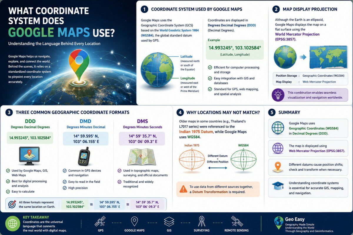
🛰️ Google Maps ใช้พิกัดแบบไหน? ทำไมจึงค้นหาตำแหน่งได้แม่นยำทั่วโลก
ทุกวันนี้ Google Maps กลายเป็นส่วนหนึ่งของชีวิตประจำวัน ไม่ว่าจะเป็นการค้นหาเส้นทาง การแชร์ตำแหน่ง การเรียกรถ หรือการนำทางด้วยสมาร์ตโฟน เบื้องหลังการทำงานของระบบเหล่านี้คือ พิกัดภูมิศาสตร์ (Geographic Coordinates) ซึ่งทำหน้าที่เป็น “ภาษากลาง” สำหรับการระบุตำแหน่งบนพื้นผิวโลก
หลายคนอาจสงสัยว่า Google Maps ใช้พิกัดแบบใด? และเหตุใดบางครั้งเมื่อนำพิกัดจากแผนที่เก่าหรือเอกสารรังวัดมาเปิดใน Google Maps จึงพบว่าตำแหน่งไม่ตรงกัน
━━━━━━━━━━━━━━
🌍 Google Maps ใช้ระบบพิกัดอะไร?
Google Maps ใช้ ระบบพิกัดภูมิศาสตร์ (Geographic Coordinate System : GCS) ที่อ้างอิงกับ World Geodetic System 1984 (WGS84) ซึ่งเป็นพื้นหลักฐาน (Datum) มาตรฐานสากลที่ใช้ร่วมกับระบบดาวเทียม GPS
ตำแหน่งบนโลกจะถูกกำหนดด้วย
📍 Latitude (ละติจูด)
📍 Longitude (ลองจิจูด)
โดยทั่วไป Google Maps จะแสดงพิกัดในรูปแบบ Degrees Decimal Degrees (DDD) หรือ Decimal Degrees (DD) เช่น
14.993245°, 103.102584°
รูปแบบนี้เหมาะสำหรับการคำนวณด้วยคอมพิวเตอร์ การวิเคราะห์ในระบบ GIS และการเชื่อมโยงข้อมูลจากดาวเทียมทั่วโลก
━━━━━━━━━━━━━━
📍 เหตุใดจึงใช้ DDD?
แม้ว่าพิกัดภูมิศาสตร์จะมี 3 รูปแบบ ได้แก่
🛰️ DDD (Degrees Decimal Degrees)
🧭 DMD (Degrees Minutes Decimal)
🗺️ DMS (Degrees Minutes Seconds)
แต่ Google Maps เลือกใช้ DDD เนื่องจากมีข้อดีหลายประการ
✅ รองรับการคำนวณด้วยคอมพิวเตอร์
✅ เชื่อมต่อกับฐานข้อมูลเชิงพื้นที่ได้ง่าย
✅ ประมวลผลเส้นทางและระยะทางได้รวดเร็ว
✅ เป็นมาตรฐานเดียวกับ GPS และระบบ GIS สมัยใหม่
━━━━━━━━━━━━━━
🌐 แล้วทำไม Google Maps ถึงดูเหมือนเป็นแผนที่ราบ?
แม้โลกจะมีลักษณะเป็นทรงรี (Ellipsoid) แต่การแสดงผลบนหน้าจอจำเป็นต้องแปลงพื้นผิวโลกให้เป็นระนาบ จึงใช้ระบบฉายแผนที่ Web Mercator Projection (EPSG:3857)
กล่าวคือ
- การจัดเก็บตำแหน่ง ใช้พิกัดภูมิศาสตร์บน Datum WGS84
- การแสดงผลบนหน้าจอ ใช้การฉายแผนที่แบบ Web Mercator
นี่คือเหตุผลที่ Google Maps สามารถแสดงข้อมูลจากทั่วโลกได้อย่างต่อเนื่องและลื่นไหล
━━━━━━━━━━━━━━
⚠️ ทำไมพิกัดจากแผนที่เก่าจึงไม่ตรงกับ Google Maps?
ในประเทศไทย แผนที่ภูมิประเทศรุ่นเก่าหลายชุด เช่น L7017 ใช้พื้นหลักฐาน Indian 1975 ขณะที่ Google Maps และแผนที่ภูมิประเทศรุ่นใหม่ เช่น L7018 ใช้ WGS84
เมื่อ Datum แตกต่างกัน พิกัดของตำแหน่งเดียวกันจะไม่ตรงกัน หากไม่นำข้อมูลมาปรับค่าด้วยกระบวนการ Datum Transformation ก่อนใช้งาน
ดังนั้น ก่อนนำข้อมูลจากแผนที่เก่าเข้าสู่ Google Maps หรือระบบ GIS ควรตรวจสอบทั้ง Datum และ Coordinate System ทุกครั้ง
━━━━━━━━━━━━━━
🎯 สรุป
Google Maps ใช้ ระบบพิกัดภูมิศาสตร์ (Geographic Coordinate System) บนพื้นหลักฐาน WGS84 และแสดงพิกัดในรูปแบบ Degrees Decimal Degrees (DDD) ขณะที่การแสดงผลบนหน้าจอใช้ Web Mercator Projection เพื่อให้สามารถแสดงข้อมูลได้ทั่วโลก
การเข้าใจความแตกต่างระหว่าง Coordinate System, Datum และ Map Projection ถือเป็นพื้นฐานสำคัญสำหรับนักภูมิศาสตร์ นักสำรวจ และผู้ปฏิบัติงานด้าน GIS เพราะเป็นปัจจัยที่ส่งผลโดยตรงต่อความถูกต้องของข้อมูลเชิงพื้นที่
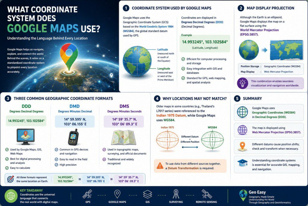
🛰️ What Coordinate System Does Google Maps Use?
Google Maps has become an essential tool for navigation, location sharing, and spatial information in everyday life. Behind its seamless operation lies a standardized geographic coordinate framework that enables accurate positioning anywhere on Earth.
A common question is: What coordinate system does Google Maps use?
━━━━━━━━━━━━━━
🌍 Geographic Coordinate System (WGS84)
Google Maps uses the Geographic Coordinate System (GCS) based on the World Geodetic System 1984 (WGS84), the global standard datum also used by the Global Positioning System (GPS).
Locations are referenced using two coordinates:
📍 Latitude
📍 Longitude
Coordinates are typically displayed in the Degrees Decimal Degrees (DDD) format.
Example:
14.993245°, 103.102584°
━━━━━━━━━━━━━━
📍 Why Does Google Maps Use DDD?
Among the three common geographic coordinate formats:
🛰️ Degrees Decimal Degrees (DDD)
🧭 Degrees Minutes Decimal (DMD)
🗺️ Degrees Minutes Seconds (DMS)
Google Maps primarily adopts DDD because it is ideal for digital computation and geospatial databases.
Its advantages include:
✅ Efficient computer processing
✅ Easy integration with GIS databases
✅ Fast routing and spatial analysis
✅ Global compatibility with GPS technology
━━━━━━━━━━━━━━
🌐 Why Does Google Maps Look Flat?
Although the Earth is an ellipsoid, digital maps require a flat surface for display.
Google Maps therefore uses the Web Mercator Projection (EPSG:3857) for visualization.
In summary:
- Position storage: Geographic Coordinates on WGS84
- Map display: Web Mercator Projection
This combination allows smooth global visualization and navigation.
━━━━━━━━━━━━━━
⚠️ Why Do Older Maps Sometimes Not Match Google Maps?
Many historical topographic maps, including older Thai map series, were produced using the Indian 1975 Datum, whereas Google Maps uses WGS84.
Because the underlying datums differ, identical physical locations may appear offset unless a Datum Transformation is performed.
Therefore, GIS professionals should always verify both the coordinate system and the datum before integrating data from different map sources.
━━━━━━━━━━━━━━
🎯 Conclusion
Google Maps stores locations using the Geographic Coordinate System (WGS84) in the Degrees Decimal Degrees (DDD) format while displaying maps with the Web Mercator Projection.
Understanding the relationship between coordinate systems, datums, and map projections is fundamental for geographers, surveyors, GIS analysts, and anyone working with spatial data, ensuring accurate positioning and reliable geospatial analysis.
Geo Easy : Geography Made Simple
Understanding the World Through Geography and Geoinformatics





ความคิดเห็น